SBC LTER Data Catalog
Publicly available datasets, organized into research collections.
Local Temperature Data
Visualized data from local Santa Barbara Coastal Long Term Ecological Research (SBC LTER) study sites.
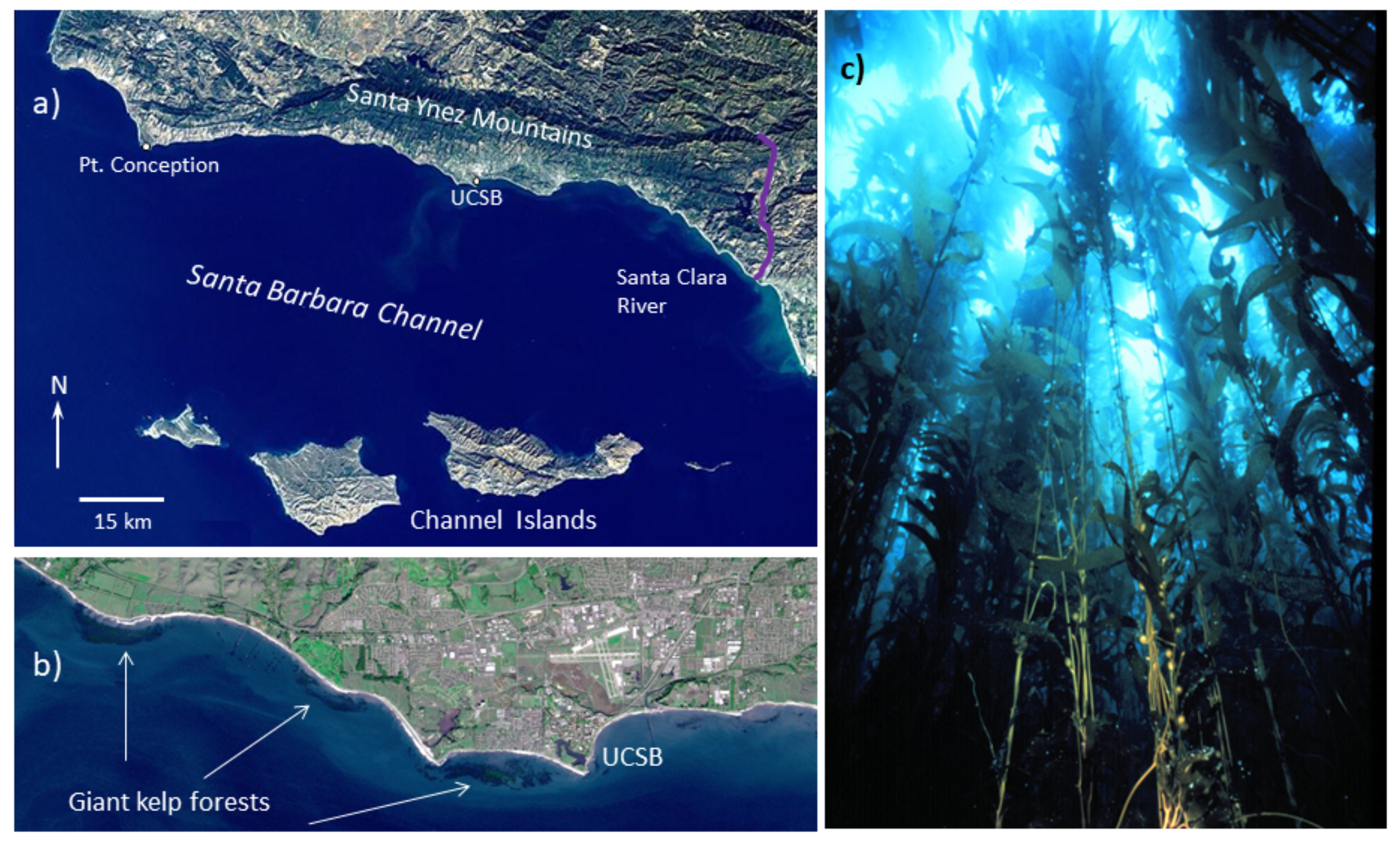
(a) Map of the SBC LTER study domain, (b) Satellite image showing the close proximity of giant kelp forests to the land-sea interface, (c) Submarine view of a giant kelp forest. Figure from SBC LTER website.
Marine Heatwave Data
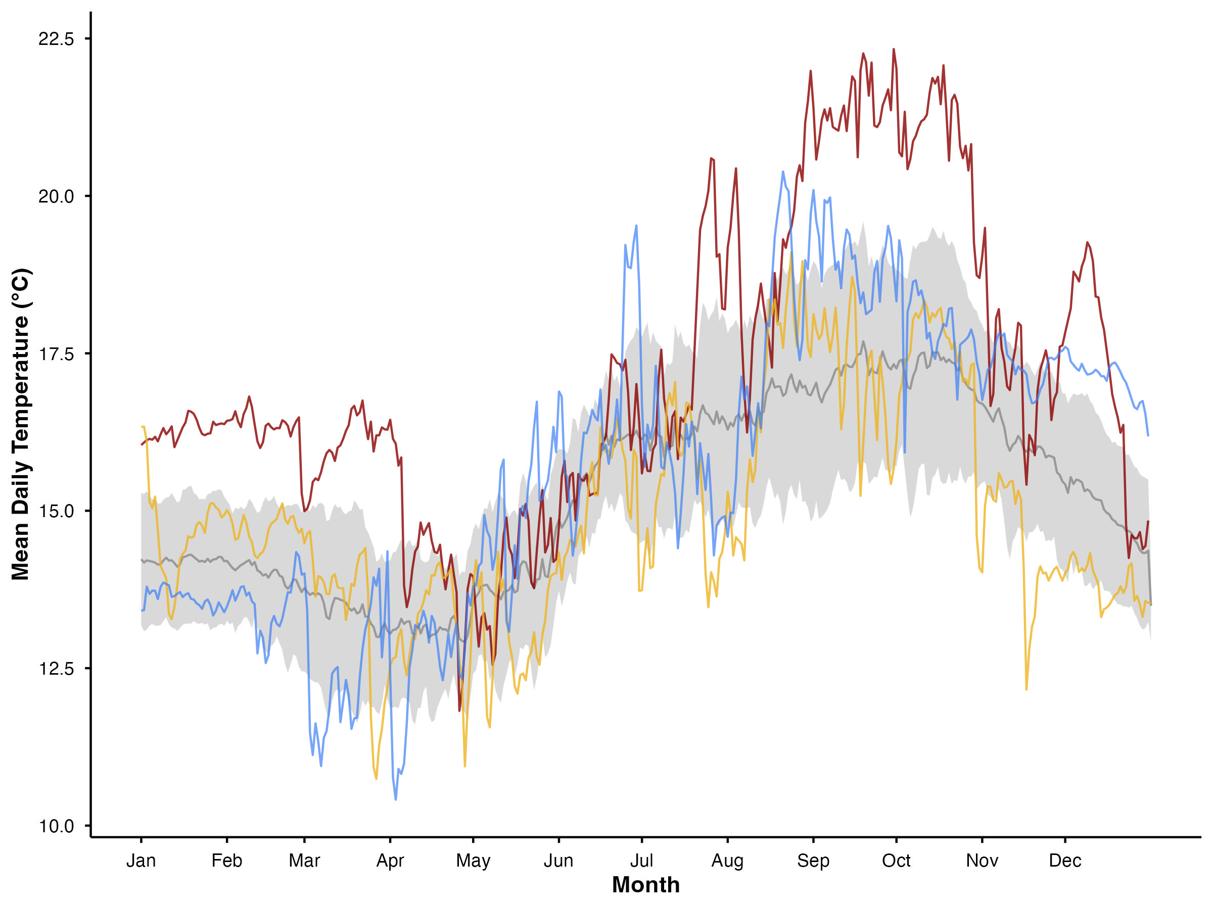
Benthic temperature data from Mohawk Reef as a time series. Temperature (°C) data were recorded on the benthos via sensors deployed on a mooring at 1m off the substrate. Gold line: mean daily temperature for 2024; Blue line: mean daily temperature for 2025; Red line: mean daily temperature for 2015, one of the Blob years shown to illustrate an extreme MHW year; Grey line: climatological mean (mean daily temperature) from 2002-2025, where the shaded area represents +/- 1 SD.
More Coming Soon!